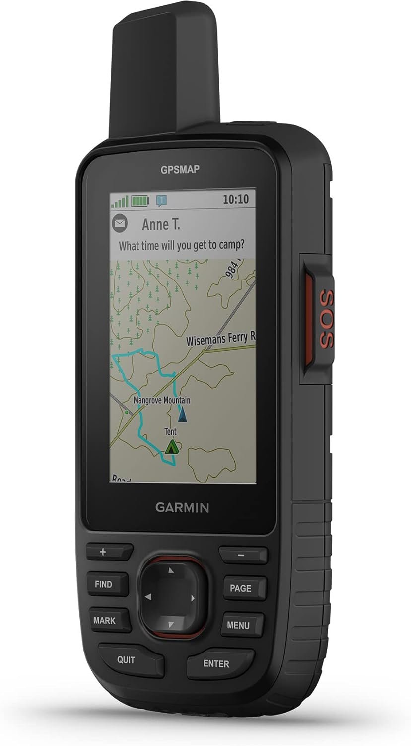
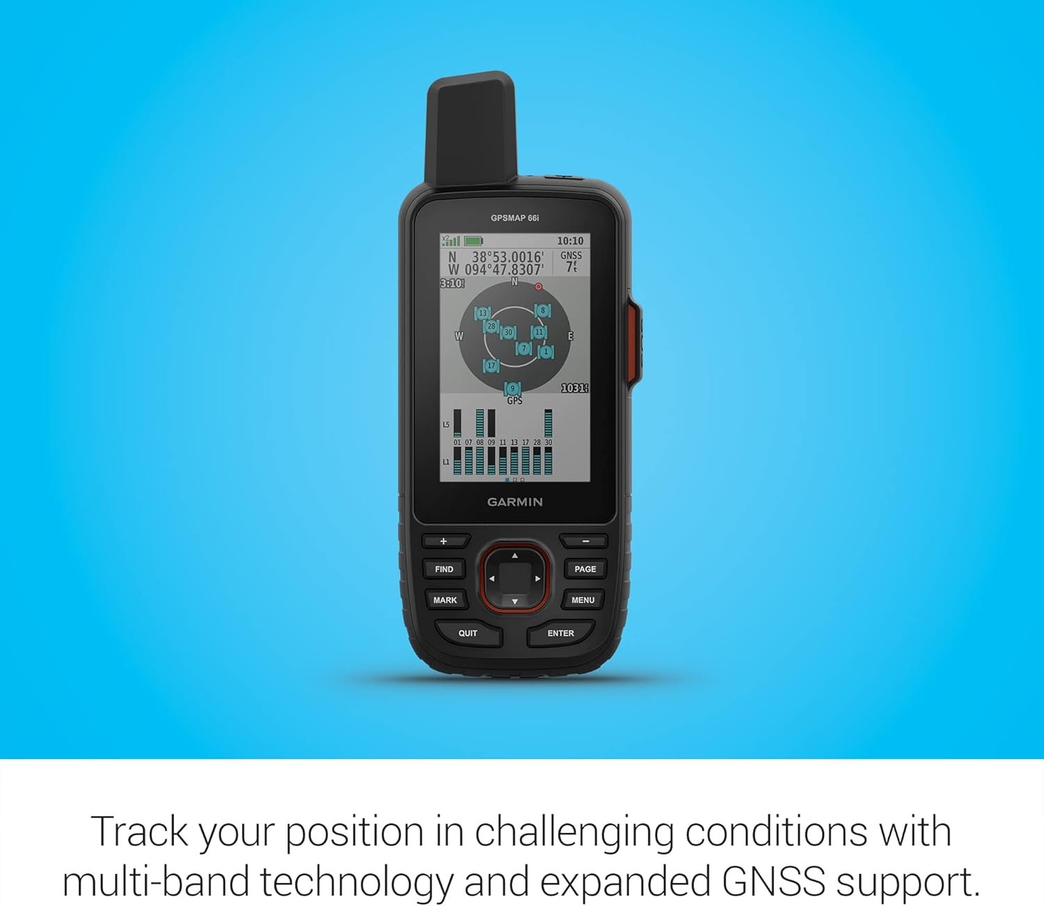
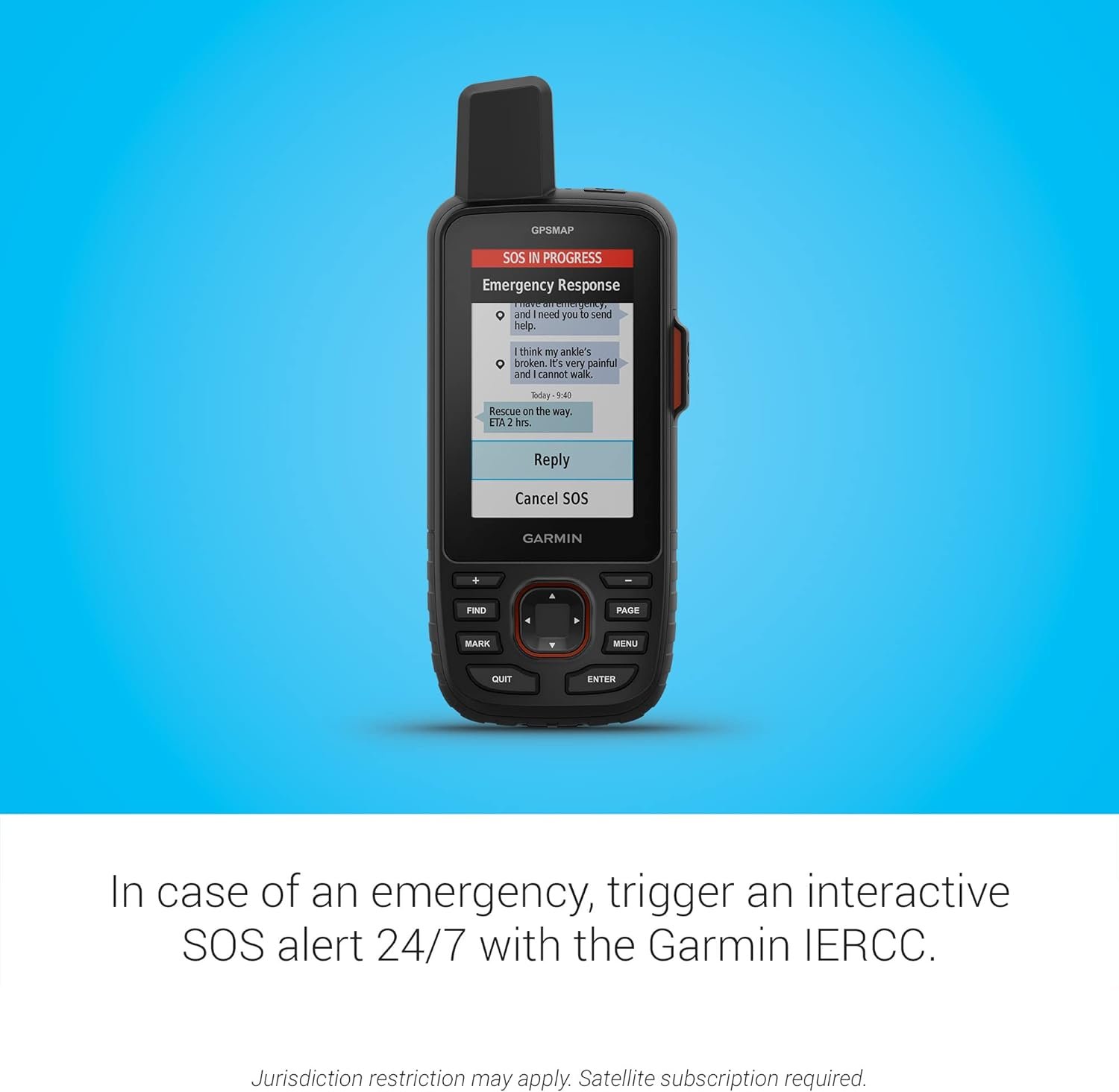
The Garmin GPSMAP 67i Rugged GPS Handheld with inReach® Satellite Technology is your ultimate companion for outdoor adventures. Boasting a large 3-inch sunlight-readable color display, this device ensures you never miss a detail, no matter the conditions. With its robust features, including two-way messaging and location tracking across the global Iridium satellite network, plus interactive SOS capabilities to connect you with 24/7 emergency response services, safety and communication are right at your fingertips. The GPSMAP 67i also comes with preloaded TopoActive mapping, satellite imagery, and multi-band GNSS support, ensuring you navigate with confidence. When paired with your compatible smartphone, you can access active weather forecasts and Geocaching Live, while the Garmin Explore website or app aids in trip planning. Enhanced by an Outdoor Maps+ subscription, this device delivers premium mapping content via Wi-Fi. With an impressive battery life of up to 165 hours in tracking mode and up to 425 hours in expedition mode, your adventures are limitless. Have you ever wondered what it would be like to have a reliable companion for all your outdoor adventures? Imagine never getting lost no matter where you are, and always having a way to communicate even in the most remote locations. That’s exactly what the Garmin GPSMAP 67i Rugged GPS Handheld with inReach® Satellite Technology offers. With features that range from a large, sunlight-readable display to two-way messaging and interactive SOS, this gadget might just become your ultimate outdoor partner.
Key Features
Large 3” Sunlight-Readable Color Display
One of the standout features of the Garmin GPSMAP 67i is its large, 3-inch sunlight-readable display. This makes it incredibly easy to view your maps and settings even in bright sunlight. Gone are the days of squinting at a screen, trying to discern your route.
Two-Way Messaging and Location Tracking
Communicate easily no matter where you are with the 100% global Iridium satellite network. This enables you to send and receive messages as well as share your location. The device can be a crucial lifeline when you’re miles away from the nearest signal tower.
Interactive SOS
Safety is paramount when you’re out in nature, and the interactive SOS feature adds a layer of security. By triggering an SOS, you can reach Garmin Response℠, a 24/7 staffed emergency coordination center. Note that an active subscription and compliance with local regulations are required.
TopoActive Mapping and Satellite Imagery
Navigate like a pro with preloaded TopoActive maps and access to satellite imagery. Whether you’re hiking, biking, or backpacking, these maps offer unparalleled detail and accuracy to ensure you always stay on the right path.
Multi-Band GNSS Support and Sensors
The device features multi-band GNSS support, meaning it can access multiple satellite constellations. This makes location tracking more accurate, especially in challenging terrains like deep canyons or dense forests.
Smartphone Connectivity
Pair the GPSMAP 67i with your compatible smartphone to access active weather forecasts and Geocaching Live. This connectivity enhances your experience by providing real-time information and creating an interactive outdoor journey.
Use with Garmin Explore Website or App
Planning trips has never been easier. The Garmin Explore website or app allows you to set up routes, waypoints, and much more, which you can then sync with your handheld device.
Premium Mapping Content via Outdoor Maps+
Get exclusive access to a wide variety of premium maps delivered directly to your device through Wi-Fi with an Outdoor Maps+ subscription. This feature enriches your navigation system with detailed and up-to-date information.
Long Battery Life
You’ll never have to worry about the device dying mid-adventure. The internal, rechargeable lithium battery provides up to 165 hours in 10-minute tracking mode and up to 425 hours in expedition mode with 30-minute tracking intervals. This long battery life ensures you’re never left without critical navigation capabilities.
This image is property of Amazon.com.
Detailed Breakdown
Understanding all these features separately can seem overwhelming, so let’s break down the information in a simple table for easier understanding:
| Feature | Description | Benefits |
|---|---|---|
| Display | 3” Sunlight-Readable Color | Easy viewing in bright sunlight |
| Messaging | Two-Way via Iridium Satellite | Stay connected globally |
| SOS | Interactive to Garmin Response℠ | Reliable emergency support |
| Maps | Preloaded TopoActive and Satellite Imagery | Accurate navigation |
| GNSS Support | Multi-Band | Enhanced accuracy in challenging environments |
| Smartphone Connectivity | Pair with Compatible Smartphone | Access to active weather forecasts and Geocaching Live |
| Garmin Explore | Website and App | Trip planning and syncing |
| Premium Maps | Outdoor Maps+ via Wi-Fi | High-quality, updated mapping content |
| Battery Life | Up to 165 hours (10-minute tracking) / 425 hours (30-minute tracking) | Long-lasting use for prolonged adventures |
This image is property of Amazon.com.
How to Make the Most of Your Garmin GPSMAP 67i
Setting Up Your Device
Unboxing your Garmin GPSMAP 67i is the beginning of an exciting adventure. The first thing you’ll want to do is charge the device fully. Most likely, the battery will come with some charge, but topping it off ensures you won’t run out of power quickly.
After charging, turn on the device and go through the initial setup prompts. This will include setting your language, pairing with your smartphone if you choose, and linking it to your Garmin account.
Navigating the Interface
The interface is user-friendly but taking a few minutes to familiarize yourself with it can make a big difference. Spend some time exploring the menus and settings. Customize the display to show the information you find most useful, whether that’s battery life, current location, or immediate waypoints.
Planning Your Adventure
Using the Garmin Explore app or website is a game-changer for planning. Here, you can set up routes, create waypoints, and even share your planned trips with friends or family. All this data syncs seamlessly with your handheld device, ensuring you’re all set for your journey.
Using Maps and GNSS
Garmin’s TopoActive maps are incredibly detailed. Take advantage of this by studying your planned routes beforehand. When you’re on the go, rely on the multi-band GNSS support to keep your location tracking accurate, even in tricky terrains.
Staying Connected
Utilize the two-way messaging to stay in touch with your loved ones, or, if you’re in a group, to communicate seamlessly with your team. If you encounter an emergency, the interactive SOS feature ensures you can get help promptly.
Monitoring the Weather
Don’t underestimate the importance of active weather updates. These forecasts can help you avoid unfavorable weather conditions, making your trips not only safer but also more enjoyable.
Extending Battery Life
Optimize battery usage by adjusting the tracking intervals. For extended trips, utilize the expedition mode which extends the battery life up to 425 hours. Also, turn off non-essential features when they aren’t needed to save power.
This image is property of Amazon.com.
Real-world Applications
Hiking and Backpacking
For hikers and backpackers, this device is a dream come true. The detailed maps, accurate GNSS support, and long battery life mean you can tackle those off-the-beaten-path trails with confidence. Additionally, the SOS feature adds a layer of security that’s invaluable when you’re miles away from civilization.
Geocaching
If geocaching is your thing, you’ll find this device immeasurable. The ability to access Geocaching Live through smartphone pairing means you can get real-time updates on available caches in your area, making the hunt as enjoyable as the find.
Cycling and Mountain Biking
With excellent mapping capabilities and a durable design, the Garmin GPSMAP 67i is also ideal for cyclists and mountain bikers. The preloaded TopoActive maps provide accurate trail data, and the rugged build can withstand the bumps and scrapes that are part of off-road biking.
Emergency Preparedness
Whether you’re a first responder, adventurer, or someone who just loves to explore, this device features the interactive SOS and global satellite messaging ensure you’re always prepared for the unexpected.
This image is property of Amazon.com.
Customer Feedback and Reviews
Across various platforms, customers have praised the Garmin GPSMAP 67i for its reliability and rich feature set. One user mentioned, “This device has transformed how I approach outdoor activities. From hiking in dense forests to mountain biking, I can always rely on accurate location tracking and essential communication.”
Another reviewer stated, “The SOS functionality is a game-changer. During a recent trip, I had a medical emergency, and the Garmin Response℠ team was able to coordinate search and rescue effectively.”
Of course, no product is without its critiques. Some users have noted the need for a subscription for certain features as a minor drawback. However, most agree that the benefits far outweigh this requirement.
This image is property of Amazon.com.
Final Thoughts
In summary, the Garmin GPSMAP 67i Rugged GPS Handheld with inReach® Satellite Technology is a phenomenal device that will elevate your outdoor activities to a new level. Whether you’re an avid hiker, an enthusiastic cyclist, or someone who just loves the thrill of the great outdoors, this gadget is an invaluable companion.
From its sunlight-readable color display to its extensive battery life, two-way messaging, and interactive SOS, the Garmin GPSMAP 67i truly stands out in the market. So gear up, plan your next adventure, and let this fantastic device guide and protect you every step of the way.
Disclosure: As an Amazon Associate, I earn from qualifying purchases.


