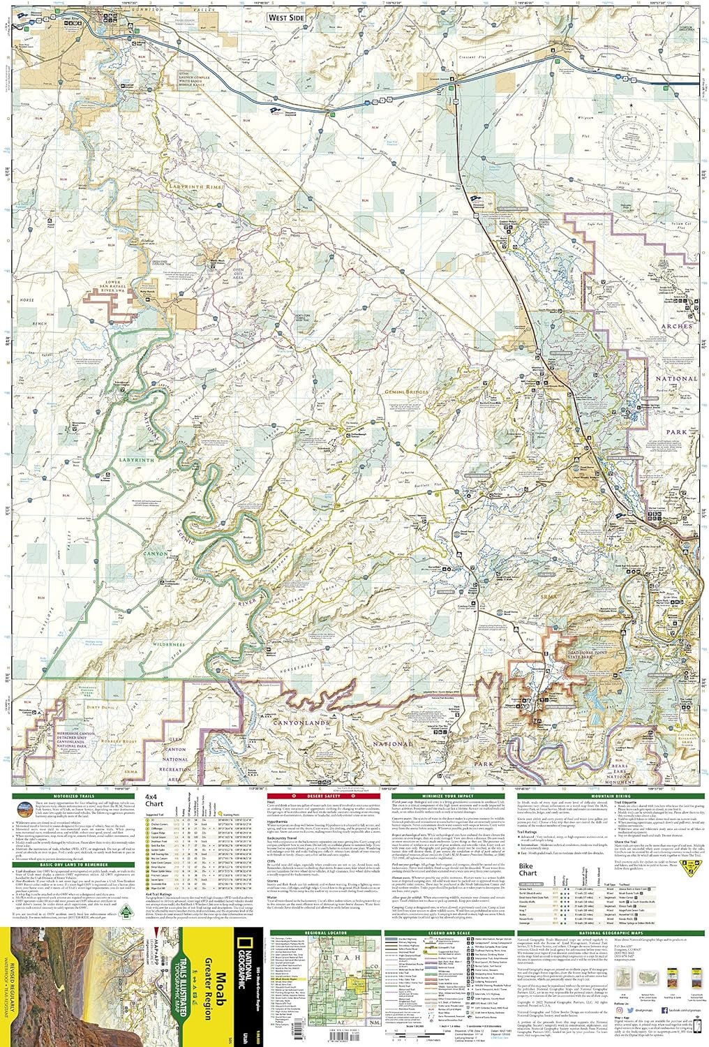
Discover the breathtaking landscapes and trails of the Moab Greater Region with the National Geographic Trails Illustrated Map, 505. This indispensable guide provides detailed topographic information, helping outdoor enthusiasts navigate the area’s numerous hiking, biking, and off-road adventures. With user-friendly details and accurate trail information, this map is your key to a memorable and safe exploration of one of nature’s most beautiful playgrounds. Have you ever found yourself lost in the sprawling beauty of Moab’s landscapes, wishing for a reliable guide to lead the way? The “Moab Greater Region Map (National Geographic Trails Illustrated Map, 505)” might just be the perfect companion for your next adventure. Whether you’re an avid hiker, an enthusiastic biker, or simply a lover of the great outdoors, this map promises to deliver the coverage and detail you need to explore with confidence.
Why Opt for the Moab Greater Region Map (National Geographic Trails Illustrated Map, 505)?
Choosing the right map is crucial, and you might be wondering what sets this one apart from others on the market. The National Geographic Trails Illustrated Map series is renowned for its accuracy, durability, and comprehensive detail, and map number 505, covering the Moab Greater Region, is no exception.
Detailed Coverage
The Moab Greater Region Map covers an extensive area, including Arches National Park, Canyonlands National Park, and several state parks and wilderness areas. You won’t miss out on any of the breathtaking sites Moab is famous for.
Durability
Printed on waterproof and tear-resistant material, this map is designed to withstand the elements. Whether you’re caught in an unexpected downpour or navigating through rugged terrains, your map will remain intact and readable.
Accurate Topographic Information
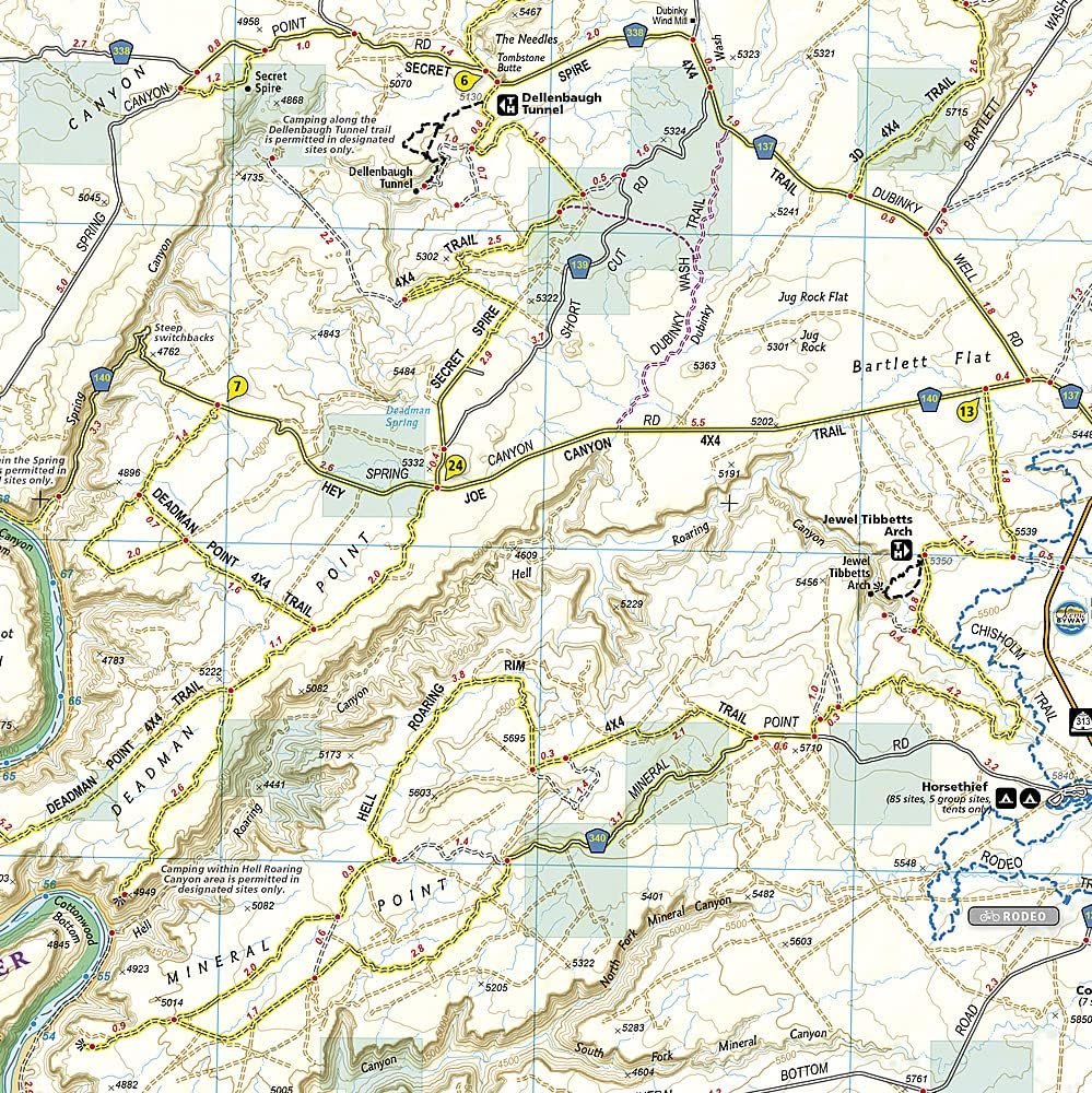
One of the standout features of this map is its topographic detail. Elevation changes, contour lines, and shaded relief bring the landscape to life on paper, helping you understand the lay of the land intuitively.
Trail and Road Markings
The map includes marked trails, roads, and even points of interest such as campsites, scenic overlooks, and historic sites. This makes planning your trip simple and enjoyable, highlighting all the must-see spots along the way.
| Feature | Description |
|---|---|
| Area Coverage | Arches National Park, Canyonlands National Park, state parks, and wilderness areas |
| Durability | Waterproof, tear-resistant material |
| Topographic Detail | Elevation changes, contour lines, shaded relief |
| Markings | Trails, roads, points of interest |
Who Is This Map For?
While the “Moab Greater Region Map (National Geographic Trails Illustrated Map, 505)” is incredibly versatile, it particularly shines for certain types of adventurers.
Hikers
If you’re someone who loves exploring on foot, this map offers a detailed look at various hiking trails, from easy strolls to challenging treks. You’ll get clear indications of trailheads, distances, and difficulty levels.
Mountain Bikers
Moab is a paradise for mountain bikers, and this map ensures you don’t miss any of the best routes. With bike trails clearly marked, you can find paths suited to your skill level, be it easy riding or extreme downhill tracks.
Campers and RVers
For those planning to camp or travel by RV, this map provides information on campgrounds and RV sites. You’ll also find information on available amenities, so you know what to expect in advance.
Sightseers
If you’re more interested in the sights than the workout, no worries. This map points out scenic viewpoints, historic sites, and other unique points of interest that make Moab so special.
This image is property of Amazon.com.
Navigating the Map: A Step-by-Step Guide
Navigating a detailed map might seem daunting at first, but with a bit of practice, you’ll find it straightforward and incredibly rewarding. Here’s how to make the most of your Moab Greater Region Map.
Unfold and Orient Your Map
First things first, find a flat surface to unfold your map. Align it according to the compass directions to get your bearings. The map includes a compass rose for quick orientation.
Identify Your Starting Point and Destination
Look for the location where you plan to start your adventure and where you aim to go. These could be identified by standard map symbols, such as a tent for campgrounds.
Examine the Terrain
Take a moment to examine the terrain between your starting point and destination. The topographic details, including contour lines, can give you a good idea of the elevation changes you might encounter.
Choose Your Route
Based on the identified trails and roads, select the best route for you. Consider factors like trail difficulty and distance to ensure it matches your skill level and stamina.
Cross-Check Points of Interest
Make a note of any points of interest along the way to ensure you don’t miss out on great views or historical markers.
Keep the Map Handy
As you venture out, keep the map within easy reach. Frequent check-ins with your map can help avoid wrong turns or missed opportunities.
Benefits of Using a Physical Map Over Digital Maps
In an era where digital maps are becoming the norm, you might wonder why you’d want a physical map like this one. Well, there are several compelling reasons.
No Need for Batteries or Signal
Unlike digital devices, a physical map doesn’t require batteries and works regardless of signal availability. This is especially useful in remote areas where mobile service can be spotty.
Greater Spatial Awareness
A physical map allows you to see the bigger picture. You can lay it out and track large areas at once, leading to better spatial awareness and easier trip planning.
Tangibility and Reliability
There’s something infinitely trusting about holding a physical map in your hands. It’s a reliable backup that doesn’t rely on technology, which can fail you at critical moments.
This image is property of Amazon.com.
Real User Experiences
What’s a product review without real feedback from users who have put it to the test? Here are some experiences shared by avid adventurers who have tried the Moab Greater Region Map.
Sarah, Avid Hiker
“I’ve used this map on several hiking trips in Moab, and it’s been a game-changer. The level of detail is impressive, and it’s saved me from getting lost more times than I can count. I especially appreciate the durable material; it’s practically indestructible!”
Mike, Mountain Biker
“As a mountain biker, finding the right trails is crucial. This map laid out all the essential trails and even some lesser-known gems. It’s easy to read, and the elevation details helped me prepare for the more challenging parts.”
Karen, RV Traveler
“Traveling in our RV, we needed a reliable map to find campsites and navigate the parks. This map had everything we needed, and we felt much more prepared knowing accurate information was at our fingertips.”
Tom, Sightseer
“I’m not much of an outdoorsy person, but I love exploring natural beauty. This map made it easy to find all the scenic viewpoints and interesting spots without having to hike miles. Perfect for a leisurely trip!”
Tips for Maximizing Your Map’s Potential
To truly get the most out of your Moab Greater Region Map, keep these tips in mind.
Study Before You Go
Familiarize yourself with the map before your trip. Knowing where you’re headed and the lay of the land can make real-time navigation easier and less stressful.
Use Alongside a Compass
While the map itself is extremely detailed, pairing it with a compass can provide an added layer of navigation accuracy, especially in rugged terrains.
Laminate for Extra Protection
Even though the map is already pretty durable, some outdoor enthusiasts prefer to laminate their maps for added protection from the elements. You might find this useful if you’re planning an extended trip.
Take Notes
Using a pencil or a non-permanent marker, you can jot down notes directly on your map. Mark your favorite spots, note important directions, or highlight potential new routes for future trips.
This image is property of Amazon.com.
Compare with Other Maps
It’s always a good idea to compare products before making a purchase. Here’s how the Moab Greater Region Map stacks up against other popular maps in the market.
| Feature | Moab Greater Region Map (Nat Geo) | Competitor 1 | Competitor 2 |
|---|---|---|---|
| Coverage Area | Extensive, includes major parks | Limited, fewer parks included | Moderate, misses some key areas |
| Material | Waterproof, tear-resistant | Paper, easily damaged | Semi-waterproof |
| Topographic Information | Detailed, with elevations | Basic, lacks some details | Moderate, some elevation info |
| Trail and Road Markings | Comprehensive | Fair, missing some trails | Good, but less detailed |
| Points of Interest | Numerous, well-marked | Some, not as detailed | Adequate, fewer points listed |
As you can see, the Moab Greater Region Map offers a robust set of features that outshine many competitors, especially in terms of durability and detailed information.
Environmental Considerations
In today’s world, being environmentally conscious is more important than ever. The National Geographic Trails Illustrated Maps are printed with environmentally friendly inks and paper, minimizing the ecological footprint. Using a physical map also reduces the need for single-use batteries and contributes to less electronic waste.
This image is property of Amazon.com.
Conclusion
So, there you have it—the “Moab Greater Region Map (National Geographic Trails Illustrated Map, 505)” is an incredibly reliable, detailed, and durable map that can elevate your outdoor adventures in Moab. Whether you’re hiking, biking, sightseeing, or camping, this map provides you with all the information you need to explore confidently and thoroughly. Don’t let your next Moab adventure be hindered by inadequate navigation tools—invest in this map and unlock the true potential of your journey.
Happy adventuring!
Disclosure: As an Amazon Associate, I earn from qualifying purchases.


